Location: Home >> Detail
J Sustain Res. 2025;7(2):e250029. https://doi.org/10.20900/jsr20250029
 ,
José Manuel Naranjo Gómez 2,3,4,6 ,
Dainora Jankauskienė 7,8 ,
Vivita Pukite 8
,
José Manuel Naranjo Gómez 2,3,4,6 ,
Dainora Jankauskienė 7,8 ,
Vivita Pukite 8
1 Department of Civil Engineering and Geology (DECG), Faculty of Exact Sciences and Engineering (FCEE), University of Madeira (UMa), Funchal 9000-082, Portugal
2 CITUR—Madeira—Research Centre for Tourism Development and Innovation, Funchal 9000-082, Portugal
3 VALORIZA—Research Centre for Endogenous Resource Valorization, Polytechnic Institute of Portalegre (IPP), Portalegre 7300, Portugal
4 Research Group on Environment and Spatial Planning (MAOT), University of Extremadura, Badajoz 06071, Spain
5 RISCO—Civil Engineering Department, University of Aveiro, Aveiro 3810-193, Portugal
6 School of Agricultural Engineering, University of Extremadura, Badajoz 06007, Spain
7 Faculty of Technology, Klaipeda State University of Applied Sciences, Bijunu str. 10, Klaipeda LT-91274, Lithuania
8 Department of Land Management and Geodesy, Latvia University of Life Sciences and Technologies, Jelgava LV-3001, Latvia
* Correspondence: Sérgio Lousada.
Madeira Island, as the principal territory of the Madeira Archipelago, requires the adoption of more precise and adaptive planning strategies to address its regional challenges. Funchal’s steep topography, high population density, and expansion of impermeable surfaces increase risks of flash floods and soil erosion, while urban growth pressures threaten agricultural and forested areas. Given the urgency of this matter in the context of sustainability, planning strategies must be founded on and strengthened by a range of studies covering diverse themes to comprehensively understand the underlying issue. Utilizing tools such as Geographic Information Systems (GIS), this research facilitates an examination of variations and patterns in land use and occupancy within the municipality of Funchal on Madeira Island. The study offers a comprehensive insight into the stagnation of the region’s urban fabric and, conversely, the evolving dynamics of agricultural cultivation within the county. Findings highlight a decline in broad-leaved and coniferous forests, replaced by urban areas and transitional woodland shrub, reflecting both anthropogenic pressures and natural regeneration. The study underscores the alarming scenario of native vegetation loss attributed to human activities, reinforcing the need for more assertive monitoring by regional government entities to safeguard and preserve these landscapes, environments, and ecosystems.
The growing need for thorough and reliable information on land cover, land uses, and their transformations has driven the development of numerous global land-use datasets. These datasets, obtained via Earth observation satellites, play a crucial role in assessing territorial dynamics and environmental changes [1–4]. At the European level, initiatives such as the Copernicus Land Monitoring Service and the CORINE Land Cover (CLC) database provide valuable land-cover data through standardized methodologies, supporting decision-making for sustainable spatial planning [3,5–14].
Land-use and land-cover (LULC) maps are fundamental for integrating environmental, economic, and social factors in spatial planning. These datasets enable the monitoring of land-use trends, urban expansion, and ecological transformations, particularly in regions undergoing rapid development [15–18]. In this context, the application of Geographic Information Systems (GIS) and remote sensing supports detailed spatial analyses, enabling researchers and policymakers to track landscape dynamics and develop adaptive land management strategies [19–23]. However, while these tools are widely applied at national and continental scales, island regions such as Madeira require specific analyses that account for their unique spatial and environmental constraints [18,24–27].
Madeira, as an insular and ultraperipheral region, faces significant land-use challenges due to its steep topography, high population density, and reliance on tourism-driven economic growth [3,11–13,28–30]. Over the last few decades, rapid urbanization and infrastructural expansion have reshaped Madeira’s land-use patterns, resulting in increased pressure on both terrestrial and coastal environments [6,31–39]. As an island with finite land resources, the sustainability of land-use change must be assessed within the context of its carrying capacity—the maximum level of human occupation and resource consumption that can be maintained without degrading ecosystem functions. Changes in hydrology, particularly increased surface runoff and sedimentation due to urban expansion, illustrate the fragility of this balance and highlight the need for adaptive territorial planning. In particular, the capital city, Funchal, has experienced substantial territorial expansion along primary watercourses, leading to significant hydrological and ecological impacts [3,12,40]. The increase in impermeable surfaces has exacerbated surface runoff, raising the frequency and intensity of flash floods, a recurrent hazard in the region [31,36,41–43]. Thus, any land-use modifications must align with the region’s natural limitations, ensuring that urban expansion, agricultural shifts, and infrastructure development do not exceed Madeira’s ecological thresholds.
Integrated Coastal Zone Management (ICZM) is a critical approach to mitigating the environmental risks associated with Madeira’s land-use transformations. ICZM principles emphasize a holistic, cross-sectoral strategy that considers the interconnections between coastal and terrestrial processes, ensuring sustainable land-use planning in a region highly vulnerable to climate change, erosion, and extreme weather events [3,6,11,19]. This integrated perspective is essential for balancing urban expansion with ecosystem protection, reducing flood risks, and enhancing coastal resilience [31,40,41].
The objective of this study is to analyze land-use dynamics in Funchal between 1990 and 2018, applying GIS-based analysis to assess spatial transformations and their implications for territorial planning. By identifying key trends in urban expansion and evaluating their environmental consequences, this research aims to provide evidence-based recommendations for optimizing land use within ecological limits. Rather than focusing on “sustainable growth”, which may be misleading in an insular context, this study emphasizes the importance of adaptive planning strategies that acknowledge Madeira’s carrying capacity. Through the integration of remote sensing data and ICZM principles, this study contributes to the ongoing discourse on land-use resilience in small island territories, offering insights for more effective regional policies.
The Madeira Archipelago is positioned in the North Atlantic within the Macaronesia region, located between the latitudes 30°01′N and 33°08′N, and the longitudes 15°51′W and 17°30′W of Greenwich [30,44]. Encompassing a total area of 796.77 km2, the archipelago is composed of Madeira Island, the largest and most significant island in the group, covering 736.75 km2; Porto Santo, spanning 42.17 km2; the Desertas Islands, with an area of 14.23 km2; and the Selvagens, covering 3.62 km2 [11,29,30,36,41,44]. The Table 1 presents a summary of the main physical characteristics of the island of Madeira.
Funchal is a city and a municipality Portuguese, being the capital of the Madeira Archipelago. It has an urban area of 76.15 km2, latitude and longitude coordinates for Funchal are: 32°39'4"N, 16°54'35"W [37,46]. The municipality of Funchal, coinciding in area and population with the city, is divided into ten parishes: Imaculado Coração de Maria, Monte, Santa Luzia, Santa Maria Maior, Santo António, São Gonçalo, São Martinho, São Pedro, São Roque and Sé. The municipality is bordered to the north by the municipality of Santana, to the northeast by the municipality of Machico, to the east by the municipality of Santa Cruz and to the west by the municipality of Câmara de Lobos and to the south by the Atlantic Ocean, as shown in Figure 1. The Selvagens Islands also depend administratively on the municipality of Funchal, although they do not constitute any parish. Desertas depends on neighboring Santa Cruz [37,46].
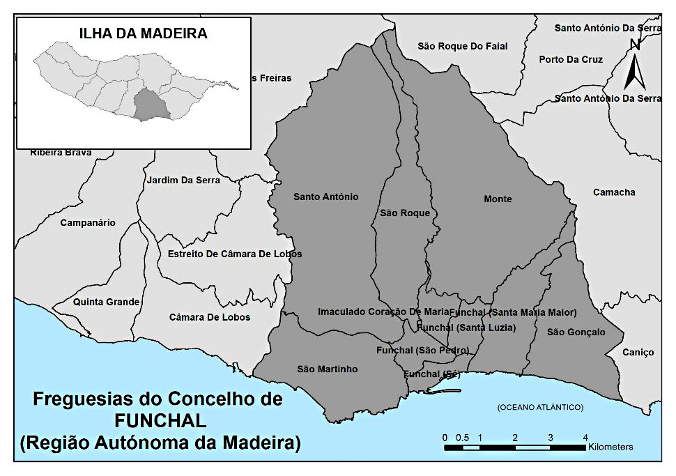 Figure 1. Location of the study area—municipality of Funchal (source: [37]).
Below are some images of the municipality of Funchal and some of its ten parishes, as shown in Figure 2.
 Figure 2. Surveying the study area, encompassing the municipality of Funchal and several of its ten parishes.
The geomorphology of Funchal reveals itself as a genuine catchment basin, as it is characterized by steep slopes from its mountains to the north and east and volcanic peaks to the west. The delineation of the urban perimeter extends from sea level to approximately 800 m in altitude, with a concentration of residential and commercial spaces in the intermediate and lower zones, particularly downstream of the streams [37,47].
The climate in Funchal is of a Mediterranean nature, with an average annual temperature hovering around 20 ℃ and a humidity level that remains nearly constant throughout the year at around 70%, enhancing the perceived temperature compared to actual values [37,46,47]. Two distinct periods can be essentially distinguished during the year. One spans from December to April, referred to as the mild season, with an average maximum temperature of 18 ℃ in mid-December. The other period extends from July to September (possibly into early October), featuring an average maximum temperature of 26 ℃ at the end of August [37,47].
The rainfall pattern exhibits regular variations and is divided into two main seasons. The rainy season extends from October to mid-April, with a notable concentration between December and February, recording monthly average rainfall values exceeding 30 mm in both months. The peak occurs in mid-December with a value of 36 mm. Conversely, the less rainy season spans from mid-April to late September, with significantly lower precipitation levels. The minimum is typically around mid-July, registering only 1 mm. Due to its geomorphology, reaching an altitude of 1800 m, two distinct climates can often be observed in the same city. Higher elevations experience more cloudiness, rain, and wind, while coastal areas typically have clearer skies. Nevertheless, occasional cloud stagnation events, partly explaining some historical extreme precipitation events, occur due to the city’s characteristics [37,45,47].
Regarding the population, according to the 2021 census, the resident population of the Autonomous Region of Madeira was 250,744. The municipality of Funchal accounts for approximately 42.2% of the population of Madeira Island, with 105,782 inhabitants. The municipality of Funchal follows the trend of population reduction, from 112,746 inhabitants in 1981 to 103,961 in 2001, and to 105,782 in the last census carried out in 2021 [48]. Funchal ranks first among Madeira’s municipalities both in terms of population and population density, standing at 1387.9 inhabitants per square kilometer, being the sixth largest city in the country [48,49].
Applied MethodologyThe utilized data comprised two publicly available information layers, facilitating the reproducibility of this study in alternative environments. The analysis centers on the Funchal municipality situated on Madeira Island.
To ensure a structured and systematic approach, the literature review was conducted through a keyword-based search in Scopus, Web of Science, and Google Scholar. The search terms included ‘land-use change in island territories’, ‘GIS-based land-use analysis’, and ‘CORINE Land Cover monitoring in Macaronesia’. Studies were selected based on relevance to Madeira and Macaronesian territories, methodological robustness (GIS-based approaches), and publication date (2018–2024). The exclusion criteria involved low spatial resolution, outdated methodologies, or geographically irrelevant case studies. The data collection process was conducted using official datasets, including the CORINE Land Cover dataset from the European Environment Agency (EEA) and administrative boundaries from the National Geographic Information System of Portugal (SNIG). These datasets ensured consistency in spatial analysis across the five study years (1990, 2000, 2006, 2012, and 2018).
Firstly, data on land use was gathered. The European Environment Agency (EEA) provides a geodatabase containing polygonal graphical representations of land use across the European Union for the years 1990, 2000, 2006, 2012, and 2018 through the CLC project [3,50]. Remote sensing data was utilized, with information delivered in the form of shapefiles. These files were managed using ArcGIS 10.5, where a project was established, and subsequently, the shapefiles were added as layers to represent vectorial information.
The mapping system utilized was the Universal Transverse Mercator (UTM), employing a scale of 1:100,000 within the Geodesic Reference System, corresponding to Madeira 1936/UTM zone 28N (EPSG:2191) [37,38,51]. The Minimal Cartographic Unit (MCU) was established at 25 hectares. Over time, precision has improved, with accuracy decreasing from over 50 m in 1990 to under 25 m in 2000, 2006, and 2012, ultimately achieving less than 10 m in 2018. Additionally, polygon information was hierarchically organized into three layers (Table 2).
 Table 2. The nomenclature of CORINE Land Cover (source: [50] *).
The next layer of data displays the administrative borders delineating the municipality of Funchal. Acquired from the National Geographic Information System of Portugal (SNIG), these boundaries adhere to the Official Administrative Charter of Portugal (CAOP2020) for the Autonomous Region of Madeira, depicted in Figure 3.
 Figure 3. The demarcation of the geographical scope under scrutiny encompasses the boundaries of the Municipality of Funchal.
Next, the GIS management software ArcGIS 10.5 was employed to handle both data layers. After adopting the MapTiler—EPSG:2191 DEPRECATED as the official coordinate reference system [3,12,51], all data layers were converted to this system by assigning a projection in the project [3,52]. This method was chosen because the inputs reflect the projection of equivalent areas within the territory, forming the foundation for EPSG. As a result, it establishes a standardized system for uniform units across Europe, guaranteeing consistent representation of analytical and statistical data.
After conducting a query using alphanumeric data, the municipality of Funchal was selected to represent the administrative divisions of the Autonomous Region of Madeira. This municipality was then merged into a single layer of information, and the study focused exclusively on this layer. The boundary of Funchal was used as the reference layer for the clip tool, which was applied for each of the considered years (1990, 2000, 2006, 2012, and 2018). Land uses within the municipality were obtained using this method, and the area of each polygon was measured geometrically and converted to hectares using the geometry command. Consequently, the total hectares for each polygon, corresponding to the representation of land uses according to the CLC nomenclature, were determined.
Alphanumeric data from tables for the analyzed years were exported using the export command and then imported into a database managed by the Microsoft Access database management program, which is part of the Microsoft Office 365 suite.
Structured Query Language (SQL) was employed to create selection queries aligned with the CLC nomenclature. These queries were further enhanced with additional grouping queries. Subsequently, the total number of hectares for each type of land use was calculated for the years 1990, 2000, 2006, 2012, and 2018.
Thematic maps were generated for each year, considering both numerical and geographic outcomes. This process facilitated the identification of areas with the highest land use diversity and those dominated by specific land uses. The data flow described in the preceding paragraphs is illustrated in Figure 4.
 Figure 4. The data flow utilized for conducting the analysis.
A system was developed to improve understanding of the methodology employed and the criteria utilized in selecting case studies, as illustrated in Figure 5.
 Figure 5. Synopsis of the criteria chosen for the methodology and the process of selecting the case study.
The results originate from an examination of land-use alterations in the municipality of Funchal spanning from 1990 to 2018, including the interim periods of 1990 to 2000, 2006, and 2012. Graphs, tables, and thematic maps are utilized to illustrate the findings. This typology of revealed outcomes aids in extracting the most pertinent information and outlining the progression of land use among the 44 soil uses identified by CLC. The data is depicted as percentages and elaborated upon in Table 3.
 Table 3. Percentage of land uses classified under level 3 CLC nomenclature within the municipality of Funchal.
To improve the visualization of area fluctuations according to CLC classification, the graph depicted in Figure 6 was generated utilizing percentages.
 Figure 6. Percentage of land use within the Funchal municipality categorized under level 3 of the CLC classification.
To determine the variations in area extent for each land use, the discrepancies in percentage areas between years were computed and outlined in Table 4.
 Table 4. Percentage difference of land uses classified under level 3 CLC nomenclature within the municipality of Funchal.
To better illustrate the differences in area extension for each land use over time based on CLC classification, a graph was generated, as depicted in Figure 7, utilizing percentages.
 Figure 7. Percentage difference of land use within the Funchal municipality categorized under level 3 of the CLC classification.
The data in Table 4. and Figure 7 reveal several notable trends in land-use dynamics over time. Between 1990 and 2000, the most substantial increase was observed in CLC-112 (discontinuous urban fabric surfaces), which rose by 5.81%, reflecting an early phase of urban expansion. This growth came at the expense of agricultural areas, particularly CLC-242 (complex cultivation patterns), which declined by 3.48%, and CLC-243 (land principally occupied by agriculture with significant areas of natural vegetation), which decreased by 2.17%. Between 2006 and 2012, a sharp decline occurred in forested areas—especially CLC-311 (broad-leaved forest) and CLC-312 (coniferous forest) reductions of 5.29% and 4.50%, respectively, likely linked to urban pressure and fire events. In contrast, the period from 2012 to 2018 shows a strong ecological recovery, marked by a 13.81% increase in CLC-322 (moors and heathland) and an 8.88% rise in CLC-324 (transitional woodland shrub), indicating natural regeneration processes or reforestation efforts. The spike in CLC-334 (burnt areas) in 2012 (+16.74%) and its sharp drop by 2018 (−16.36%) reflect the impact and aftermath of major wildfires in the region. These variations highlight the dual forces of anthropogenic pressure and ecological regeneration shaping the landscape of Funchal. Moreover, through the utilization of ArcGIS 10.5 GIS software, it was feasible to accurately illustrate the location of each area (thematic cartography), aligning with individual CLC classifications and temporal variations for each area, as illustrated in Figures 8–12. The analysis of land-use changes in the municipality of Funchal between 1990 and 2018 reveals notable trends. The most significant transformation is the expansion of artificial surfaces, particularly the CLC-112 (discontinuous urban fabric surfaces), which increased by 5.7%. This urban growth has largely replaced by CLC-242 (complex cultivation patterns), and CLC-243 (land principally occupied by agriculture with significant areas of natural vegetation), which experienced a combined reduction of over 3%. Similarly, CLC-311 (broad-leaved forest) declined by more than 8%, indicating pressures from urban expansion and land-use shifts. Conversely, CLC-324 (transitional woodland shrub) nearly doubled in the last decade of the study period, suggesting processes of natural regeneration in certain areas. These patterns highlight the interplay between urbanization, agricultural decline, and ecological recovery, emphasizing the need for integrated land management strategies in Funchal. The spatial distribution of these transformations is more pronounced in the southern and southeastern slopes of the municipality, particularly near coastal zones and urban-access corridors, where development pressure is greatest. While this study focuses on the municipal scale, a detailed parish-level assessment could provide further granularity regarding the geographic concentration of land-use transitions.
 Figure 8. Land uses classified under level 3 of the CLC designation—municipality of Funchal in 1990.
 Figure 9. Land uses classified under level 3 of the CLC designation—municipality of Funchal in 2000.
 Figure 10. Land uses classified under level 3 of the CLC designation—municipality of Funchal in 2006.
 Figure 11. Land uses classified under level 3 of the CLC designation—municipality of Funchal in 2012.
 Figure 12. Land uses classified under level 3 of the CLC designation—municipality of Funchal in 2018.
Following the application of the previously outlined methodology, it becomes feasible to examine each classification based on its respective dynamics [53]. For the case study of Funchal, the CLC-111 (continuous urban fabric surfaces) increased slightly from 2.22% in 1990 to 2.68% in 2006 and remained constant thereafter. So, more than 80% of the land surface is covered by impermeable features like buildings, roads, and artificially surfaced areas. Non-linear areas of vegetation and bare soil are exceptional [3,53]. Similarly, CLC-112 (discontinuous urban fabric surfaces), the impermeable features like buildings, roads, and artificially surfaced areas range from 30 to 80 % of land coverage [12,53]; increased substantially from 27.11% in 1990 to 32.91% in 2000, stabilizing at 32.80% by 2006. These metrics indicate that while urbanization progressed, it was constrained by the steep topography and space limitations of the island’s capital, necessitating a focus on densification rather than sprawl [3]. This controlled growth contrasts with mainland trends, highlighting the unique challenges faced by insular urban settings.
Regarding the CLC-121 (industrial or commercial units) classification, a notable increase was observed, rising from 0.08% in 1990 to 1.10% in 2006, and remaining stable thereafter. This growth reflects the expansion of economic activities in Funchal, particularly in areas designated for commerce, light industry, and logistics. These areas likely supported the municipality’s role as a regional hub, driven by tourism-related infrastructure and service industries. However, the limited increase over the study period suggests that industrial growth was constrained by geographical limitations and a focus on maintaining Funchal’s urban aesthetic and touristic appeal [3]. In contrast, the CLC-122 (road and rail networks and associated land) classification exhibited no significant changes, maintaining a stable value of 0.42% after 2000. This stability reflects the established and relatively saturated road network in Funchal, which serves as the primary mode of transport within the municipality and connects it to other parts of Madeira Island. The lack of substantial changes in this classification indicates limited new infrastructure development in this sector, potentially due to the constrained topography and the prioritization of maintenance and optimization of existing networks over expansion. The CLC-123 (port areas) classification showed minor fluctuations, with a slight increase from 0.21% in 1990 to 0.23% in 2018. This modest growth reflects enhancements in port infrastructure to accommodate Funchal’s strategic role as a maritime hub and cruise tourism destination. Despite these improvements, the overall percentage remained low, emphasizing the compact and efficient use of port areas within the municipality. This aligns with the broader focus on leveraging Funchal’s coastal assets to support economic activities without significantly expanding the physical footprint of maritime infrastructure [41,54].
Concerning the CLC-131 (mineral extraction sites), in the case of Funchal, there was a continuous increase from 0.00% in 1990 and 2000 to 0.38% in 2006, and it remained constant until 2018. This growth may be attributed to localized extractive activities supporting urban construction projects and infrastructure development within the municipality. Concerning the CLC-132 (dump sites), the municipality under study reported a percentage value of 0.00% in 1990 and 2000. This value increased to 0.41% in 2006, reflecting temporary use of specific areas for waste management, but subsequently reduced to 0.00% in 2012 and remained constant until 2018. This decrease indicates a transition towards centralized or offsite waste treatment facilities, in line with the municipality’s emphasis on sustainable urban management and environmental protection. In turn, the CLC-133 (construction sites) in Funchal, this classification presented a percentage value of 0.00% in 1990, increased to 0.38% in 2000, and subsequently decreased to 0.00% by 2006, remaining constant thereafter. The temporary spike reflects specific construction activities likely related to urban renewal or infrastructure projects that concluded within the study period. In the case of Funchal, these areas demonstrate localized but strategic land-use changes driven by urban demands, with limited long-term land occupation under these classifications.
The observed land-use transformations in Funchal align with global assessments that identify land-use change as one of the primary drivers of environmental transformations in coastal and island regions. The Millennium Ecosystem Assessment (MEA) highlights that urban expansion, agricultural decline, and deforestation significantly affect ecosystem services, particularly in terms of water retention, soil erosion control, and biodiversity conservation [55]. In the case of Funchal, the conversion of agricultural and forested areas into impermeable urban surfaces has reduced the natural capacity for infiltration and increased surface runoff, thereby exacerbating the risks of flash floods and landslides. These findings are consistent with those from other European coastal regions facing similar urban pressures [3,12].
Relating to the CLC-141 (green urban areas), in the case of Funchal, the percentage of CLC-141 remained constant at 0.41% from 2006 to 2018, with no recorded values prior to 2006. This stability reflects the limited availability of land for new green urban areas due to the municipality’s dense urban fabric and steep terrain. However, the persistence of this classification underscores the importance placed on preserving existing green spaces to enhance urban livability, mitigate urban heat effects, and support biodiversity within the city [41]. Concerning the CLC-142 (sport and leisure facilities), this classification rose from 0.00% in 1990 to 1.10% in 2000, which decreased to 1.04% in 2006, and remained constant until 2018. This growth reflects targeted investments in public and private sports and leisure facilities to accommodate both residents and tourists, aligning with Funchal’s broader strategy of promoting health, well-being, and tourism. The creation of these facilities likely aimed to diversify the municipality’s recreational offerings, complementing its natural and cultural attractions. These classifications contribute significantly to Funchal’s urban resilience by enhancing the quality of life for residents and ensuring that the city remains an attractive destination for visitors [56,57]. Therefore, it is imperative to assess the progress of the trends observed in CLC-111, CLC-112, CLC-121, CLC-122, CLC-123, CLC-131, CLC-132, CLC-133, CLC-141, CLC-142 to implement strategies aimed at mitigating flood impacts in urban areas.
Land-use changes in Funchal have also had substantial effects on ecosystem services. The loss of natural vegetation and soil coverage has reduced the municipality’s ability to regulate water flows, increasing susceptibility to extreme weather events such as heavy rainfall episodes. The MEA framework highlights that deforestation and the spread of artificial surfaces contribute to the disruption of hydrological cycles, further exacerbating climate vulnerabilities in urban coastal areas [55,57]. This is particularly relevant in Madeira, where the steep geomorphology amplifies the negative effects of land-use change on flood risk and soil degradation. Therefore, urban planning strategies must integrate nature-based solutions to mitigate these impacts, such as implementing green infrastructure and promoting reforestation efforts in vulnerable areas [3,12,40].
Regarding the CLC-222 (fruit trees and berry plantations), in the case of Funchal, the percentage of land under this classification decreased significantly, from 2.86% in 1990 to 1.72% in 2000, and further declined to 1.09% by 2006, stabilizing at this value until 2018. This consistent reduction indicates a gradual abandonment of agricultural activities in favor of urbanization and infrastructural expansion, a trend commonly observed in urbanizing regions. This decline can be attributed to several factors, including the economic shift towards tourism and service-based industries, which are more profitable and aligned with Funchal’s role as a regional hub. Additionally, demographic changes, such as rural depopulation and aging of the farming community, have contributed to the reduction of agricultural land. The challenging topography of the municipality also limits the scalability and mechanization of these activities, making them less viable compared to other land uses. Despite the decline, these areas continue to contribute to the municipality’s biodiversity and play a role in reducing soil erosion on slopes, particularly in peripheral and rural zones. These areas also hold cultural and historical significance, representing a traditional component of Madeira’s agricultural heritage. However, the observed reductions highlight the importance of strategic land-use planning to balance urban development with the preservation of key agricultural areas that contribute to food security, landscape aesthetics, and ecological services [3,37].
Regarding the CLC-242 (complex cultivation patterns), in the case of Funchal, a significant decrease was observed over the study period, with the percentage dropping from 5.24% in 1990 to 1.77% in 2000, and further to 1.25% in 2018. This decline reflects the steady abandonment of traditional agricultural practices in favor of urbanization, a phenomenon driven by the municipality’s growing emphasis on tourism, residential expansion, and service-based industries. Additionally, the fragmented nature of these cultivated areas and the challenging topography of Funchal make them less economically viable compared to more productive and mechanized agricultural zones. Concerning the CLC-243 (land principally occupied by agriculture with significant areas of natural vegetation), a similar decreasing trend was noted. This classification declined from 3.33% in 1990 to 1.16% in 2000, with a marginal increase to 1.36% in 2018. The reduction in CLC-243 reflects a transition from mixed-use agricultural landscapes to other land uses, such as urban development or natural regeneration. However, the slight increase recorded in the later period may indicate efforts to preserve or restore these areas, emphasizing their role in maintaining ecological balance and supporting biodiversity. The trends observed in CLC-242 and CLC-243 highlight a broader pattern of agricultural decline within Funchal, driven by socio-economic changes, demographic shifts, and the municipality’s prioritization of urban development. Despite this, the remaining areas under these classifications continue to provide essential ecosystem services, including soil stabilization, water retention, and the preservation of natural habitats. The data underscores the need for integrated territorial planning that balances the pressures of urbanization with the conservation of multifunctional agricultural landscapes that contribute to environmental sustainability and cultural heritage [3,11,31,57,58].
Pertaining to the CLC-311 (broad-leaved forest), in the case of Funchal, a consistent decrease was observed over the study period, with the percentage declining from 13.89% in 1990 to 12.22% in 2000, and further to 5.68% in 2018. This substantial reduction can be attributed to urban expansion, infrastructure development, and, potentially, changes in land management practices. The loss of broad-leaved forests raises concerns about the municipality’s capacity to maintain ecological resilience and underscores the need for reforestation and conservation initiatives. The CLC-312 (coniferous forest), the percentage dropped from 8.05% in 1990 to 7.86% in 2000 and further to 1.09% in 2018. These forests, typically located in higher-altitude areas of the municipality, have been affected by pressures such as urbanization, land abandonment, and potentially climatic changes. The significant reduction in this classification emphasizes the vulnerability of these ecosystems and the critical need for adaptive management strategies to preserve their ecological functions. For the CLC-313 (mixed forest), this classification accounted for 11.15% of Funchal’s area in 1990, increased slightly to 11.30% in 2006, but ultimately dropped to 6.33% in 2018. The reduction of mixed forests reflects land-use changes driven by urbanization and agricultural decline. However, the early slight increase may suggest localized reforestation efforts or natural regeneration in certain areas. The declining trends across CLC-311, CLC-312, and CLC-313 highlight the pressures exerted on Funchal’s forested landscapes due to urban development, infrastructure projects, and socio-economic shifts. These changes compromise the municipality’s ecological stability, particularly regarding water cycle regulation, soil conservation, and climate mitigation. To address these challenges, integrated forest management and conservation strategies should be prioritized, ensuring the sustainable balance between urban growth and environmental preservation [3,31,37,38].
In regard to the CLC-321 (natural grassland), in the case of Funchal, a steady decrease was observed throughout the study period, with the percentage dropping from 13.64% in 1990 to 11.69% in 2018. This reduction can be attributed to the growing pressure from urban expansion and land-use changes prioritizing infrastructural and residential developments. Despite this decline, natural grasslands remain critical for biodiversity conservation, providing habitat for endemic species and stabilizing soils in steep terrains typical of Funchal’s topography. The CLC-322 (moors and heathland) displayed a complex trend over time, beginning with stability at 4.32% between 1990 and 2000, followed by a decline to 1.44% in 2012, and finally a significant increase to 15.25% in 2018. This sharp rise suggests a resurgence in these areas, possibly due to ecological restoration efforts or natural rewilding in lands that were previously abandoned. Moors and heathlands are particularly important for their ecological functions, including water retention and soil stabilization, and they provide critical habitats for flora and fauna. The marked growth in this category in the later years is a positive indication of Funchal’s potential for land recovery and ecological balance. The CLC-324 (transitional woodland shrub) showed fluctuations over the study period, starting at 7.17% in 1990, increasing gradually to 7.51% in 2000 and 7.74% in 2006, declining to 6.63% in 2012, and surging significantly to 15.51% in 2018. This dynamic trend reflects changes in land use driven by both anthropogenic pressures and natural processes. Early increases may signify reforestation or land abandonment leading to vegetation regrowth, while the decline in 2012 could indicate land conversion for urban or agricultural purposes. The substantial rise by 2018 highlights successful reforestation initiatives or natural regeneration processes, possibly linked to land management strategies aimed at combating soil degradation and promoting biodiversity. The combined trends in CLC-321, CLC-322, and CLC-324 reveal a nuanced interaction between urban development, ecological pressures, and restoration efforts in Funchal. While urbanization has led to the decline of natural grasslands, the recovery of moors, heathlands, and transitional woodlands underscores the municipality’s capacity for ecological resilience. These landscapes contribute significantly to mitigating the effects of climate change, supporting biodiversity, and maintaining ecosystem services critical for the sustainable development of Funchal [3,57].
In relation to the CLC-333 (sparsely vegetated areas), in Funchal, the percentage remained constant at 0.36% from 1990 to 2000, increased slightly to 0.39% in 2006, and stabilized at this value until 2012. However, a significant decrease to 0.02% was observed by 2018. This decline may indicate land-use changes driven by urbanization or natural regeneration processes. Sparsely vegetated areas in Funchal often coincide with the municipality’s steep topography and rocky outcrops, playing an essential role in preventing erosion and maintaining geodiversity. The substantial reduction by 2018 could reflect positive land management strategies aimed at revegetation or conversion to more productive land uses. The CLC-334 (burnt areas) in Funchal, this classification remained absent (0.00%) from 1990 to 2006 but recorded a sharp increase to 16.74% in 2012, followed by a decrease to 0.38% in 2018. The significant spike in 2012 corresponds to devastating forest fires that occurred in Madeira during this period, which caused extensive environmental and economic damage. The subsequent decrease by 2018 indicates recovery efforts, natural regeneration, or reforestation initiatives aimed at restoring the affected landscapes. However, the persistence of 0.38% in 2018 underscores the long-lasting impacts of such fires, as recovery in some areas remains incomplete. The contrasting trends in CLC-333 and CLC-334 highlight the dual pressures of natural constraints and human activity on Funchal’s landscape. While sparsely vegetated areas have shown signs of reduction, potentially due to improved land management or natural succession, the impact of fires remains a critical challenge for the municipality. These dynamics emphasize the need for integrated strategies that combine fire prevention, reforestation, and sustainable land-use planning to mitigate future risks and ensure the ecological stability of Funchal [3,12,31,59].
With respect to the CLC-523 (sea and ocean), in Funchal, the percentage remained relatively stable over the years, starting at 0.38% in 1990 and 2000, increasing slightly to 1.29% in 2006 and 2012, and then marginally decreasing to 1.27% in 2018. The slight increase observed during the mid-study period may be attributed to natural sediment deposition processes or the expansion of tidal flats due to coastal erosion or sea-level rise. These areas play a crucial ecological role, offering breeding grounds for marine species, protecting coastal zones from erosion, and serving as buffers against tidal surges. The minor decrease in 2018 could reflect urbanization or coastal infrastructure developments, which have gradually encroached on natural coastal areas in Funchal. The trends observed for CLC-523 underscore the delicate balance between natural coastal dynamics and human activity. While these ecosystems are vital for maintaining coastal resilience and biodiversity, their stability is increasingly threatened by urban development and climate change impacts. This highlights the need for sustainable coastal management policies that prioritize the preservation and restoration of intertidal flats to support ecological health and mitigate the risks associated with coastal flooding and erosion [30,31,41,44].
From a global view, from 1990 to 2018, it can be concluded that 60.02% of the territory of Funchal underwent changes. In total, 30.01% of the changes resulted from decreases in a given classification (CLC-222, 242, 243, 311, 312, 313, 321 and 333), while the remaining 30.01% derived from increases (CLC-111, 112, 121, 122, 123, 131, 141, 142, 322, 324, 334 and 523). The most significant changes occurred in the CLC-2 class (agricultural areas), where 3.99% of the CLC-242 (complex cultivation patterns) and 1.96% of the CLC-243 (land principally occupied by agriculture, with significant areas of natural vegetation) disappeared. The same happens with the CLC-3 class (forests and semi-natural areas), where 8.22% of the CLC-311 (broad-leaved forest), 6.96% of the CLC-312 (coniferous forest), 4.82% of the CLC-313 (mixed forest), and 1.95% of the CLC-321 (natural grassland) also disappeared.
On the other hand, there were increases in terms of land occupation regarding the CLC-1 class (artificial surfaces) due to the 5.70% increase of the CLC-112 (discontinuous urban fabric surfaces) the CLC-3 class (forests and semi-natural areas), with a 10.93% growth of the area associated with the CLC-322 (moors and heathland), and 8.34% with the CLC-324 (transitional woodland shrub). The aforementioned cover type plays crucial roles in ecosystem services, particularly in processes such as pollination and the regulation and retention of water flows [1,60].
From the information in Table 4, it can be seen that the four greatest differences occurred for the following land uses (according to the land uses identified in Table 3 in bold corresponding to the higher value founded): CLC-112 between 1990 and 2000 (increased), CLC-242 and CLC-243 between 1990 and 2000 (decreased), CLC-311, CLC-312, CLC-313 and CLC-322 between 2006 and 2012 (decreased), CLC-334 between 2006 and 2012 (increased), CLC-322 and CLC-324 between 2012 and 2018 (increased), and CLC-334 between 2012 and 2018 (decreased).
From a broader perspective, land-use change is one of the key direct drivers of global biodiversity loss, particularly in island territories where spatial constraints limit the ability of ecosystems to recover [3,55]. In Funchal, the decline in agricultural land and natural vegetation not only reduces biodiversity but also weakens essential ecosystem functions, such as carbon sequestration and climate regulation. Previous studies on island urbanization trends [31,56] highlight the need for integrated land management approaches that balance economic development with environmental sustainability. These insights further reinforce the importance of adopting territorial planning strategies that safeguard natural landscapes while accommodating urban growth.
To sum up, this study provides empirical evidence of land-use changes in Funchal and their broader implications for urban sustainability and environmental resilience. The spatial patterns identified in the study stimulate discussions and contribute to the development of principles and recommendations for future regional planning, management strategies, and policies across the municipality. These results reinforce global findings from the MEA, emphasizing that land-use changes in coastal areas are a major driver of ecosystem service loss, particularly in insular settings such as Madeira. Therefore, future research should explore the implementation of integrated coastal zone management policies to mitigate land-use impacts while ensuring sustainable development [3,55].
The land uses for the municipality of Funchal were identified through the previously described methodology, employing ArcGIS 10.5 software (Environmental Systems Research Institute (Esri), Redlands, California, USA) combined with the CORINE Land Cover nomenclature. These tools serve as essential resources for territorial planning, enabling decision-makers to contribute effectively to municipal and regional planning strategies while ensuring the integration of the concept of sustainable development.
Conclusions
This study assessed land-use and land-cover changes in the municipality of Funchal and their regional implications. The findings indicate that while urban expansion has been relatively contained, variations in dominant vegetation and land-use patterns are closely linked to the municipality’s topography and morphology. The stabilization of artificial surface growth has contributed to mitigating the impacts of extreme climatic events, such as the floods and alluvial incidents of February 2010 [3,11,37]. However, this stabilization may also reflect stagnation in economic and demographic growth, raising concerns about long-term urban development and economic resilience.
The analysis of the CLC-1 class (artificial surfaces) is crucial for evaluating urban dynamics, economic performance, and social development strategies within the municipality. Likewise, the CLC-2 class (agricultural areas) provides valuable insights into shifts in agricultural priorities, potential changes in economic activity, and the evolving balance between urbanization and rural land use. The continuous decline in cultivated land and the reduction in areas used for complex cultivation patterns and fruit production suggest the gradual abandonment of traditional agriculture in favor of urban development. This transition has significant implications for food security, landscape preservation, and rural sustainability in Funchal and the wider Madeira region [61–63].
The study also highlights the importance of monitoring and conserving the CLC-3 class (forests and semi-natural areas), which are essential for environmental protection, climate regulation, and the prevention of soil erosion. The applied methodology demonstrates significant potential for assessing compliance with environmental regulations and identifying unsanctioned activities such as illegal deforestation and burning. Moreover, sustainable forest management is essential to maintaining biodiversity and mitigating climate-related risks, particularly in fragile island ecosystems. Forest loss in the study area has been particularly pronounced in the past two decades, influenced by urban expansion, wildfires, and land abandonment, reinforcing the need for effective environmental policies [64,65].
Lastly, the CLC-5 class (water bodies) exhibited minimal changes over the study period. The coastal and marine environments surrounding Funchal play a critical role in the municipality’s ecological balance, particularly in mitigating coastal erosion, supporting biodiversity, and maintaining marine ecosystem services. While no significant expansion or reduction in water bodies was recorded, the increasing urbanization along coastal areas raises concerns about water quality, sedimentation, and potential future changes in intertidal zones. The preservation of coastal and freshwater resources must be integrated into urban and territorial planning strategies to ensure sustainable coastal management. Additionally, future studies should examine the effects of climate change, including sea-level rise and shifting precipitation patterns, on these water bodies to enhance long-term environmental resilience [31,41,44].
The findings of this study highlight the complex relationship between land-use change and socio-economic development in Funchal. While urban expansion and tourism-driven economic growth have contributed to infrastructure development, they have also led to environmental degradation and ecosystem fragility. The notion of ‘stagnation’ in economic terms must therefore be carefully assessed in the context of island sustainability. Given Madeira’s spatial limitations, a purely growth-oriented model may not be the most viable approach. Instead, a paradigm shift toward an adaptive, balanced model of socio-ecological resilience is necessary—one that ensures economic stability while prioritizing environmental integrity and social equity. Land-use analysis serves as a critical tool for understanding how to achieve this balance, enabling policymakers to align economic activities with the island’s carrying capacity, mitigate ecological risks, and foster long-term sustainability.
Given Funchal’s unique geographical constraints, integrating effective land-use planning with climate adaptation strategies is critical. The rise in impermeable surfaces exacerbates hydrological risks, increasing the likelihood of extreme runoff and flooding events. In recent years, extreme weather events in Madeira have demonstrated the urgency of incorporating nature-based solutions, such as reforestation and improved water retention strategies, into urban planning frameworks. Therefore, future planning efforts must incorporate adaptive urban policies that enhance climate resilience by balancing human activity with environmental protection [65–68].
Furthermore, topographical constraints have a substantial influence on Funchal’s urban expansion, limiting the availability of suitable land for development. The island’s steep slopes and rugged terrain naturally constrain large-scale development, leading to land-use conflicts between residential expansion, agricultural land preservation, and conservation efforts. While these natural barriers create challenges, they also help preserve ecological integrity and prevent uncontrolled sprawl. Therefore, a balanced approach to land-use planning—one that supports economic growth while ensuring environmental sustainability—is imperative [61–63].
Future studies should incorporate predictive modeling techniques to estimate potential land-use changes in Funchal over the coming decades. Methods such as Markov chains, cellular automata, or machine learning-based spatial simulations could be utilized to identify potential trends and assess how land-use patterns might evolve under different environmental, demographic, and policy-driven scenarios. Given the municipality’s ongoing urbanization and environmental constraints, predictive models could provide valuable insights to assist local authorities in developing adaptive spatial planning strategies that mitigate potential risks and promote long-term sustainable development. Additionally, it is essential to assess the landscape fragmentation resulting from the differentiation between continuous and discontinuous urban fabric. The use of advanced spatial analysis techniques, such as landscape ecology metrics and machine-learning-based urban pattern classification, can provide deeper insights into the spatial distribution of these areas and their impacts on ecological connectivity, urban infrastructure, and climate resilience. Understanding these fragmentation patterns will contribute to a more integrated approach to territorial planning, enabling the implementation of strategies that balance urban expansion with environmental preservation [3,64,69,70].
In summary, the findings of this study emphasize that land-use change serves as a fundamental indicator of human impact on natural environments. By integrating empirical data with territorial planning frameworks, policymakers can develop strategies that promote resilience, sustainable development, and the preservation of Funchal’s unique environmental and cultural assets. Future research should focus on assessing the long-term socio-economic effects of land-use transitions in Madeira, particularly concerning the sustainability of key economic sectors such as tourism and agriculture [71–74].
The data presented in this study are openly available. Also, it is possible to contact one of the study authors.
Conceptualization, SL, DJ, JMNG and VP; Methodology, SL and JMNG; Software, SL and JMNG; Validation, SL, DJ, JMNG and VP; Formal Analysis, SL; Investigation, SL and JMNG; Resources, SL; Data Curation, SL; Writing—Original Draft, SL and JMNG; Writing—Review & Editing, SL and JMNG; Visualization, SL, DJ, JMNG and VP; Supervision, SL, DJ, JMNG and VP; Project Administration, SL, DJ and VP. All authors have read and agreed to the published version of the manuscript.
The authors declare no conflict of interest.
This publication has been made possible thanks to funding granted by the Consejería de Economía, Ciencia y Agenda Digital from Junta de Extremadura and by the European Regional Development Fund of the European Union through the reference grants GR21135.
Special thanks are due to CONSTRUTEAM ENGENHARIA LDA, Civil Construction Company, for the generous financial support granted, which made this study and article publication possible. The significant contribution was fundamental to the success of this research project. We would like to express our sincere gratitude to CONSTRUTEAM ENGENHARIA LDA for the continuous support in advancing scientific knowledge within the field of civil construction. Without this sponsorship, this publication would not have been possible.
1.
2.
3.
4.
5.
6.
7.
8.
9.
10.
11.
12.
13.
14.
15.
16.
17.
18.
19.
20.
21.
22.
23.
24.
25.
26.
27.
28.
29.
30.
31.
32.
33.
34.
35.
36.
37.
38.
39.
40.
41.
42.
43.
44.
45.
46.
47.
48.
49.
50.
51.
52.
53.
54.
55.
56.
57.
58.
59.
60.
61.
62.
63.
64.
65.
66.
67.
68.
69.
70.
71.
72.
73.
74.
Lousada S, Gómez JMN, Jankauskienė D, Pukite V. Land-Use Changes in an Island Urban Setting: A Retrospective Study of Funchal, Madeira (1990–2018). J Sustain Res. 2025;7(2):e250029. https://doi.org/10.20900/jsr20250029

Copyright © Hapres Co., Ltd. Privacy Policy | Terms and Conditions


